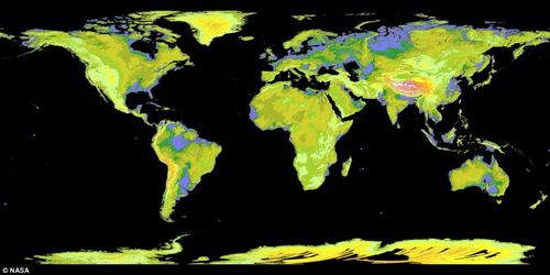
A new map from NASA offers the most complete view of elevations on Earth ever presented:
"The Global Digital Elevation Model was created using nearly 1.3 million images collected by a Japanese camera on board NASA's Terra spacecraft. It is made up of a giant grid of 23,000 tiles, with each height point spaced 98ft apart.
It shows a detailed representation of the planet's land mass. In this colorized version, low elevations are purple, medium elevations are greens and yellows, and high elevations are orange, red and white. 'This is the most complete, consistent global digital elevation data yet made available to the world,' said NASA scientist Woody Turner. It is a large improvement on the previous best topographic map, where 80 per cent of the planet's landmass was surveyed during the Shuttle Radar Topography Mission."
Click to enlarge.
In related news, scientists predict New Orleans and much of the Mississippi delta will be completely underwater by 2100.


