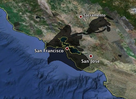
Here's an interesting look at the size of the BP oil spill in the Gulf of Mexico in comparison with various metropolitan areas. A Google Earth API has been jiggered to layer a current image of the spill so its scope can be compared to places with which you might be familiar.
In related news, efforts to cap the leak in the Gulf failed over the weekend: "After the cofferdam was lowered onto the leak site, a slurry of methane crystals formed on the inside of the dome's surface, making it bouyant and clogging the outtake at the dome's roof.
The giant box has been moved 200 meters from the disaster site, and is sitting on the sea bed. BP had anticipated that methane hydrates could form within the pipework from the dome to the surface, but not within the dome itself, especially at such a rapid rate."


